Refine

The Refine phase is the heart of the project, where most of the engineering and design work happens. This phase began by exploring Franklin Street within its transportation and land use context, asking key questions like: What do we know about how the street functions today? What type of place do we need it to be in the future? And how do we ensure it works well for all users?
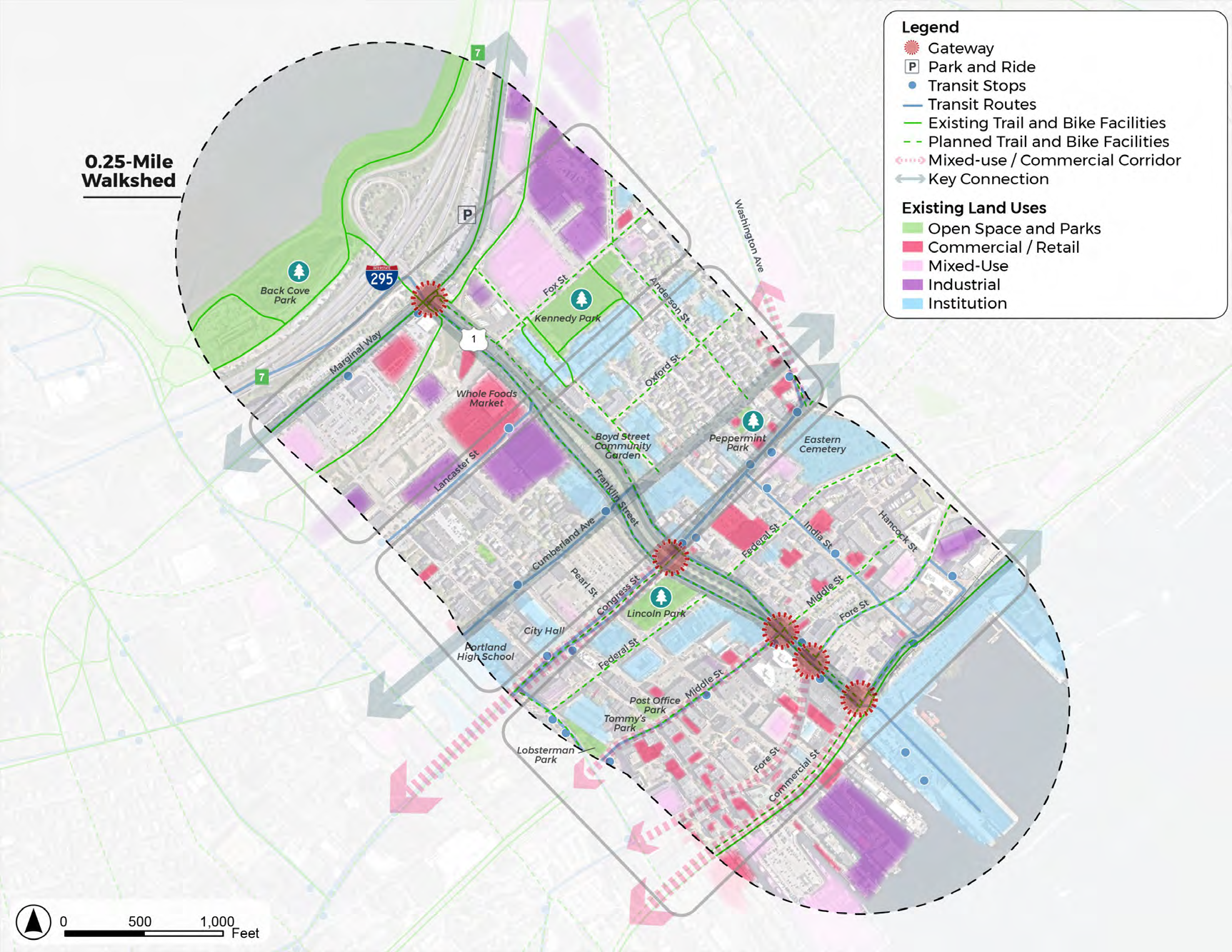
Franklin Street today provides an important connection between I-295, abutting neighborhoods, and the Commercial Street waterfront. At its northern end, in the “highway transition zone”, it carries significant traffic volumes as a primary entry point to the Portland peninsula. There are consistently two vehicular travel lanes in each direction with seven signalized intersections. There are four local streets that run perpendicular to Franklin and no longer connect through to it.
Traffic volumes drop significantly as the street moves south, where the street functions more like a typical urban roadway. At Commercial Street, traffic drops by over 70%. This change in volumes provides opportunities to “right-size'“ the street design to match the traffic and more urban context.

Traffic on Franklin Street over the last decade shows different trends on different parts of the street. At the north end and the far southern end, traffic volumes in both the morning and afternoon peak periods have been relatively flat over the decade, with slight declines or little increase. Modest increases have occurred at Cumberland and Congress Streets, with more notable growth at Middle and Fore Streets. Today, particularly in the afternoon peak hour, the northbound direction between Congress Street and Marginal Way experiences some congestion.
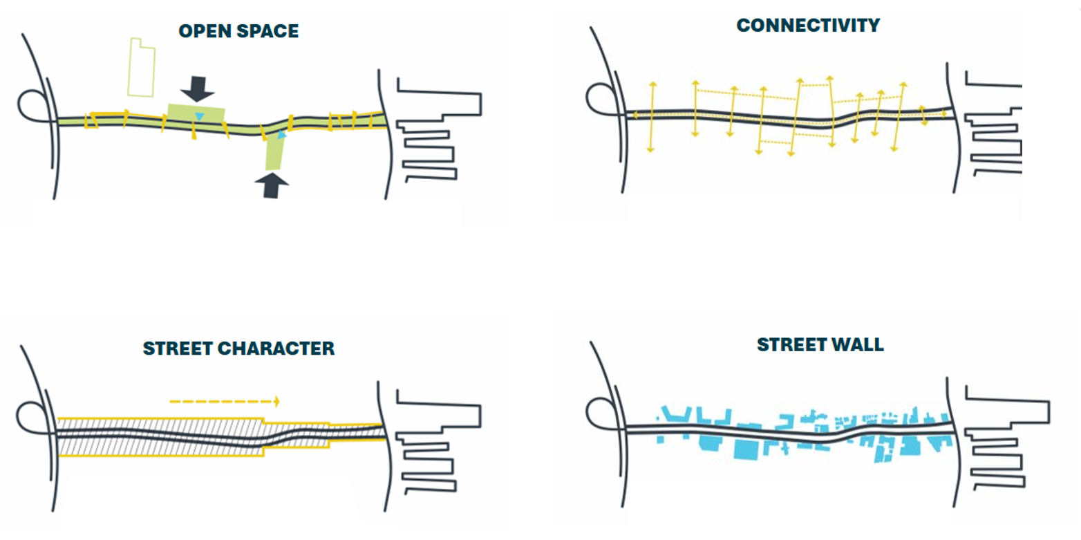
Understanding the Existing Transportation Context…


…and the Land Use Context
There is a sidewalk on at least one side of Franklin Street for its entire length, but the discontinuity of sidewalks and the distance between and across street crossings makes walking its full length difficult. There are currently no bicycle facilities.
Marginal Way acts as a major gateway to the City of Portland. From Marginal Way to Lancaster Street, the land surrounding Franklin Street is characterized by a mix of industrial, commercial, and residential land uses, including major origins and destinations like the East Bayside food hub, the northern edge of Portland Housing Authority’s residential neighborhood, and Whole Foods, all of which are set back from Franklin Street and generally oriented away from it.
South of Lancaster Street to Congress Street, the land uses shift more toward institutional uses, including City Hall, Boyd Street Garden/Park, Lincoln Park, and the Cathedral of the Immaculate Conception. This segment also includes large multi-family housing which is, again, generally oriented away from Franklin Street and large surface parking lots such as Top of the Old Port.
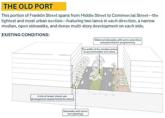
South of Congress Street, the area transitions into a greater mix of uses, with commercial, retail, and residential in some relationship to Franklin Street. On the southern end of the corridor, Commercial Street serves as another major gateway into the City.

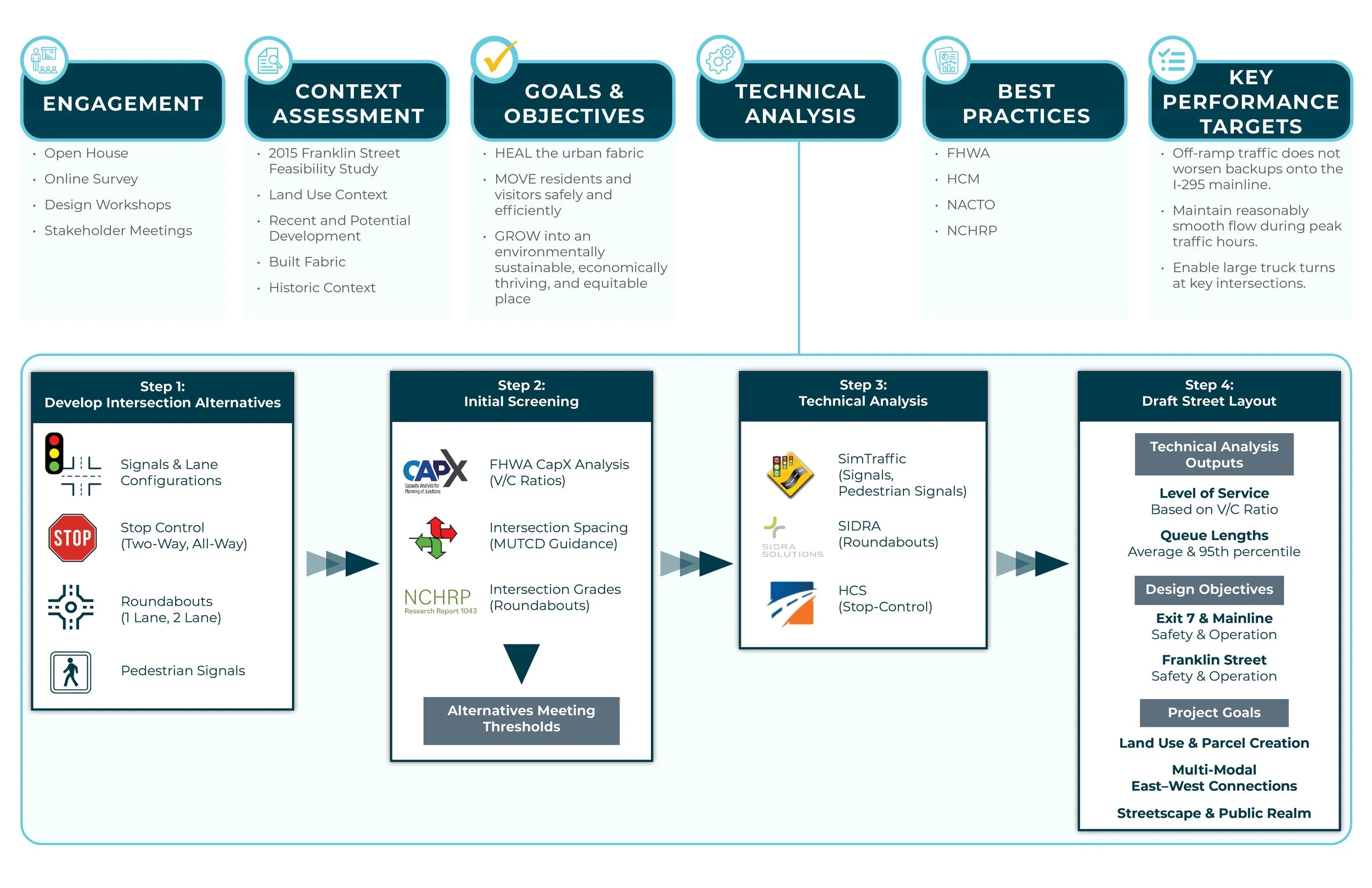
Exploring Alternatives
The next step in the refine phase was to explore a range of transportation and land use options for Franklin Street. We considered various intersection configurations, street cross-sections, and street alignments. Options included:
New connections to Lancaster, Oxford, Federal, and Newbury Streets
Intersection configurations including signals, stop-controls, and roundabouts
Various pedestrian crossing treatments
Two-way and one-way, grade separated cycle tracks
Various sidewalk widths
On-street parking
Various median and esplanade treatments
Various street alignments and resulting parcel configurations and land use opportunities
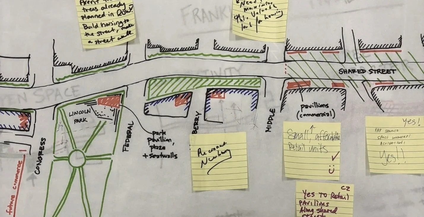
The June community design workshop gave us a chance to connect with hundreds of members of the community to hear ideas about these types of options from varied viewpoints. And this feedback provided solid principles to work with in terms of refining options for the street design and land use concept.
Testing Alternatives
The last step of the refine phase involved evaluating these options for the future street design and land use concept against the project’s goals and objectives.
How did various potential street cross-sections with differing vehicular lane configurations, bike facility designs, on-street parking arrangements, intersection treatments, and sidewalk widths stand up to projected transportation demand? How would they impact future development opportunities, strengthen connections between existing land uses and the street, and provide opportunities for landscaping and green infrastructure? And how do the alternatives support the advancement of City Council goals around equity, sustainability, and advancing Vision Zero?